Enhancing Basin-to-Prospect Opportunities
Our advanced geophysical capabilities enable accurate determination of basement depth, sedimentary thickness, and basin geometry. By integrating high-resolution gravity and magnetic data with experienced interpretation, we support informed decision-making for exploration activities. Our Gravity and Magnetic Survey solutions enhance seismic design planning and optimization by providing critical subsurface insights. These surveys support exploration teams in accurately identifying hydrocarbon potential zones while reducing uncertainty and operational risk. In addition, our magnetic survey methods deliver valuable data for mineral exploration, enabling the identification of prospective deposits through cost-effective, non-invasive techniques that maximize efficiency and reliability.

Mari’s Gravity and Magnetic Survey services are engineered to deliver exceptional precision, accuracy, and reliability. By leveraging advanced gravimeters and magnetometers, we ensure high-quality data acquisition across a wide range of terrains and operating environments, supporting dependable subsurface interpretation and informed decision-making.

We provide high-precision gravity and magnetic data acquisition for oil, gas, and mineral exploration projects.
Our gravity surveys utilize the Scintrex CG-6 Autograv™ micro-gravimeter, delivering ultra-stable readings (0.1 µGal resolution, <5 µGal repeatability) with automatic corrections for tilt, tide, temperature, and drift, supported by integrated GPS and rugged field-ready design.
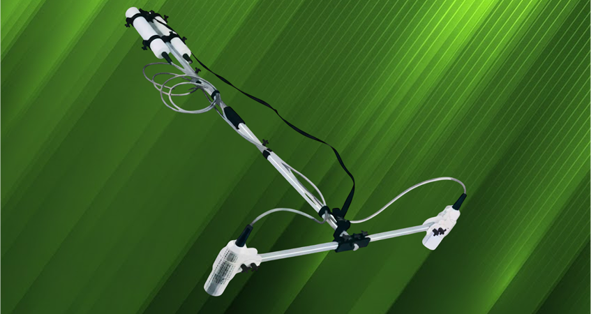
Our magnetic surveys employ GEMLink 19W proton magnetometers and ENVI CS cesium vapor magnetometers for high-resolution mapping. ENVI Cs feature GPS integration, robust data storage, and weatherproof field-ready designs, enabling efficient, high-quality data acquisition across diverse terrains.
1-ENVI Cs MAGNETOMETER (Cesium Vapor Magnetometers):
The ENVI Cs™ Magnetometer delivers industry-leading sensitivity and reliability for high-resolution magnetic surveys. Utilizing advanced Cesium vapor sensor technology, it provides rapid, low-noise measurements with exceptional accuracy, even in high-gradient environments. Lightweight, robust, and GPS-integrated. offering efficient, non-invasive data acquisition across a wide range of terrains and operating conditions.
2-GEMLink 19T Proton Precession Magnetometers:
The GEM GSM-19T Proton Magnetometer is a reliable, high-performance magnetic sensor widely used in exploration surveys. Renowned for its excellent sensitivity and stability, the 19T delivers precise total magnetic field measurements in both mobile and base-station modes. Its robust design and wide operating range make it ideal for exploration, and geological mapping across diverse terrains and conditions.